mad-science@ricepo
This package can compute isodistance polygons based on driving distance.
Getting Started
$ npm install isodistIn order to run isodist, you will need to download an *.osm file corresponding to the region
where you want to do your computation. Geofabrik is a good source of
these files.
You need to place your OSM files into the isodist/osrm directory (create one if it does not exist).
Then run the following command to generate .osrm files:
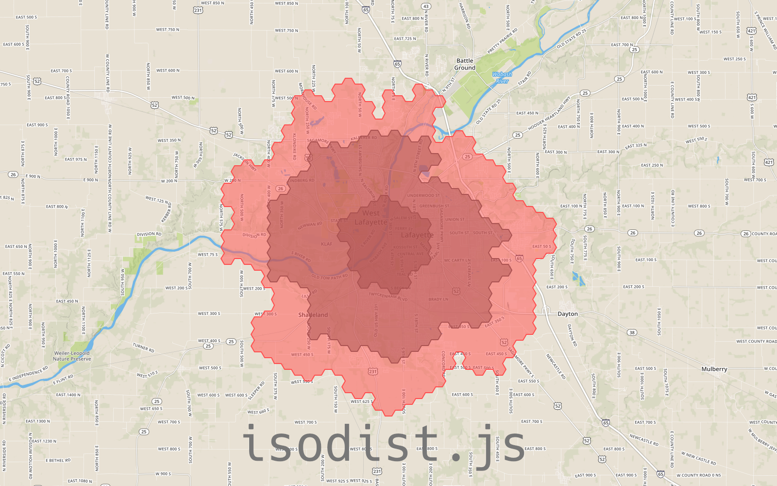
$ npm run prepareFinally, you are good to go! In order to generate the graph above, you will need indiana.osrm and
run the following:
$ isodist --lon=-86.893386 --lat=40.417202 --stops=2,5,7 --resolution=0.1 --hexsize=0.5 --deburr --osrm=inCommand Line Arguments
--lat
Required.
Latitude of the origin point.
--lon
Required.
Longitude of the origin point.
--stops
Required.
Distances at which to compute isodistance polygons.
For example, to compute isodistance polygons at 1, 2, 5 and 10 miles, use
--stops=1,2,5,10
--osrm
Required.
Name of the .osrm file you wish to use for routing.
-o, --output
Optional, default: output.json
Specifies the file where to output resulting GeoJSON FeatureCollection.
-r, --resolution
Optional, default: 0.2
Sampling resolution of the underlying point grid. Larger values will result in less precise results but much faster processing. Smaller values will produce more precise results, but will require exponentially more processing time and memory.
-h, --hexsize
Optional, default: 0.5
Size of hex grid cells that isodistances are fitted onto. Passing a 0 value will disable hex grid fitting.
--deburr
Optional, default: none
This flag instructs isodist to remove isolated "islands" from isodistance geometries.